Weather and Tide Table
Sunrise
Sunset
to Low Tide
Low Tide
High Tide
68% | 2,6 m 8.5 ft | High Tide | |
66% | 1,4 m 4.6 ft | Low Tide | |
63% | 2,8 m 9.2 ft | High Tide | |
61% | 1,4 m 4.6 ft | Low Tide | |
58% | 2,5 m 8.2 ft | High Tide | |
56% | 1,6 m 5.2 ft | Low Tide | |
53% | 2,7 m 8.9 ft | High Tide | |
50% | 1,5 m 4.9 ft | Low Tide | |
47% | 2,5 m 8.2 ft | High Tide | |
44% | 1,6 m 5.2 ft | Low Tide | |
42% | 2,7 m 8.9 ft | High Tide | |
39% | 1,4 m 4.6 ft | Low Tide | |
36% | 2,6 m 8.5 ft | High Tide | |
33% | 1,5 m 4.9 ft | Low Tide | |
31% | 2,9 m 9.5 ft | High Tide | |
28% | 1,2 m 3.9 ft | Low Tide | |
25% | 2,8 m 9.2 ft | High Tide | |
23% | 1,3 m 4.3 ft | Low Tide | |
20% | 3,1 m 10.2 ft | High Tide | |
18% | 1,0 m 3.3 ft | Low Tide | |
16% | 3,1 m 10.2 ft | High Tide | |
13% | 1,1 m 3.6 ft | Low Tide | |
11% | 3,3 m 10.8 ft | High Tide | |
9% | 0,8 m 2.6 ft | Low Tide | |
8% | 3,3 m 10.8 ft | High Tide | |
6% | 0,8 m 2.6 ft | Low Tide | |
5% | 3,5 m 11.5 ft | High Tide | |
3% | 0,6 m 2 ft | Low Tide | |
2% | 3,5 m 11.5 ft | High Tide | |
2% | 0,6 m 2 ft | Low Tide | |
1% | 3,6 m 11.8 ft | High Tide | |
0% | 0,5 m 1.6 ft | Low Tide | |
0% | 3,6 m 11.8 ft | High Tide | |
0% | 0,5 m 1.6 ft | Low Tide | |
0% | 3,7 m 12.1 ft | High Tide | |
0% | 0,5 m 1.6 ft | Low Tide | |
1% | 3,6 m 11.8 ft | High Tide | |
2% | 0,4 m 1.3 ft | Low Tide | |
3% | 3,6 m 11.8 ft | High Tide | |
4% | 0,6 m 2 ft | Low Tide | |
5% | 3,6 m 11.8 ft | High Tide | |
7% | 0,5 m 1.6 ft | Low Tide | |
About the Beach
What is Praia da Manta Rota Beach?
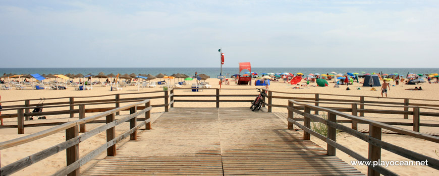
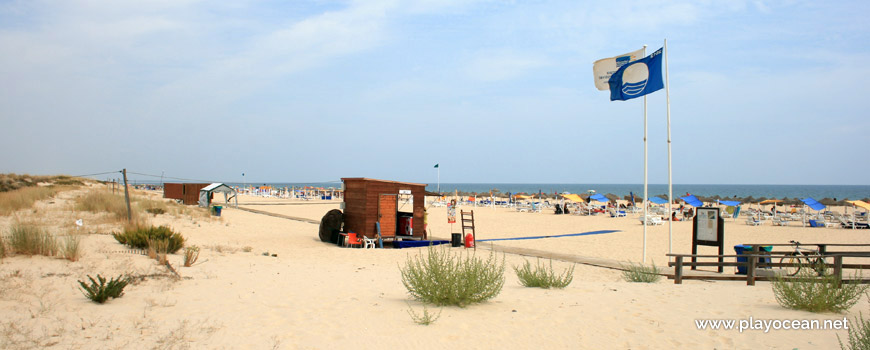
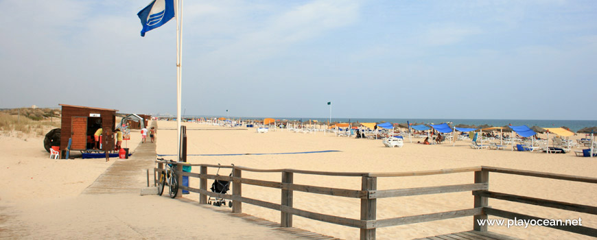
It's an Oceanic Beach in the northern hemisphere bathed by the Atlantic Ocean, located on the coast of Portugal - Iberian Peninsula - in the municipality of Vila Real de Santo António (West).
Praia da Manta Rota Beach is located at the sea front of a touristic place called Manta Rota.
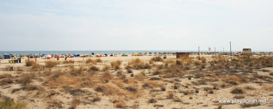
It presents a very extensive sand of about 1,3 Km. The west side is bounded by the most eastern canal of Ria Formosa1 (a valley eroded by rivers and with sandy islands which is flooded by the sea, turning the water into brackish).
The dune string is protected by wooden walkways that lead to the bathing area.
Seawater has an inviting temperature.
This is a famous beach because of its night club Manta Beach Club, placed in the middle of the sand.
References
- Formosa Stream
Where is it?
Map of Praia da Manta Rota Beach
| Coordinates Decimal Degrees (Lat/Long WGS84) Degrees, Decimal Minutes (Lat/Long WGS84) Degrees, Minutes, Seconds (Lat/Long WGS84) |
Lat. 37.163469º Lon. -7.518363º N 37º 9.80814' W 7º 31.10178' N 37º 9' 48.49" W 7º 31' 6.11" |
| Parish | Vila Nova de Cacela |
| County | Vila Real de Santo António (West) |
| District | Faro |
| Region | Algarve |
| Country | Portugal |
| Continent | Europe |
| Ocean | North Atlantic |
| Maritime Authority | Capitania do Porto de Vila Real de Santo António |
| Protected Area | Parque Natural da Ria Formosa |
| Bathing Water | Manta Rota |
| Coastal Unit | Manta Rota - Foz do Guadiana |
| Coastal Region | Costa Algarvia |
Awards
| Award | 2017 | 2016 | 2015 | 2014 | 2013 | 2012 | 2011 | 2010 | 2009 | 2008 | 2007 | 2006 |
|---|---|---|---|---|---|---|---|---|---|---|---|---|
| Water Quality | ||||||||||||
| Blue Flag | ||||||||||||
| Gold Flag | ||||||||||||
| Handicapped-Accessible Beach | ||||||||||||
| Zero Polution |
Documents
Reviews (2)
Login to Review.
-
10/ 10ParadisicaManuel Machado 2021-06-28 10:20
-
10/ 10Maravilhosa!Ana Matias 2020-08-05 17:26


