Praia da Senhora da Guia Beach
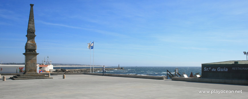
Obelisk built in tribute to a landing attempt by the troops of D. Pedro in the year of 1841.
North part of Praia da Senhora da Guia Beach.
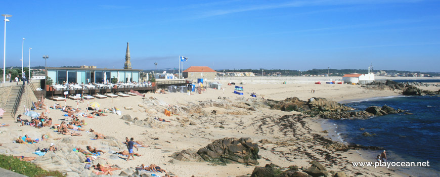
Praia da Senhora da Guia Beach, south view.
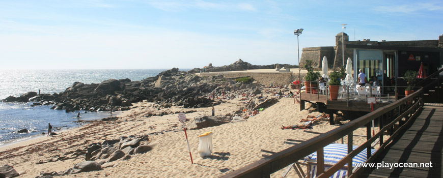
Bathing area at Praia da Senhora da Guia Beach.
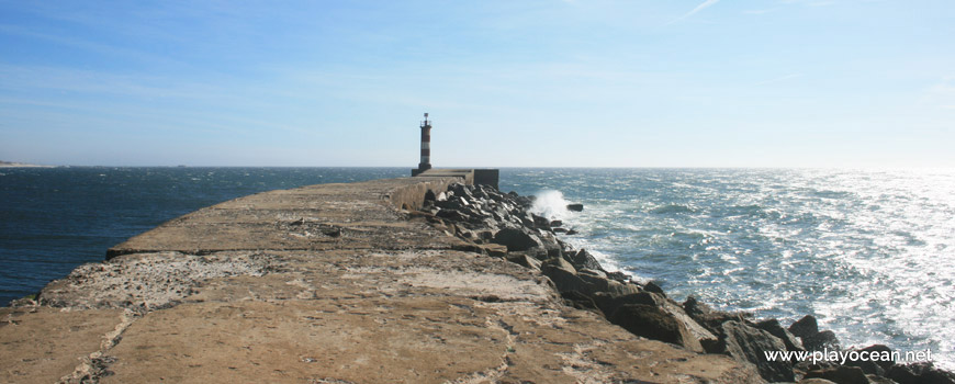
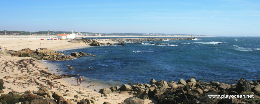
Pier of the Ave River mouth.
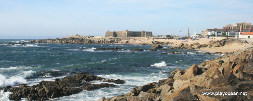
Praia da Senhora da Guia Beach, north view. Far, the São João Baptista Fort.
Weather and Tide Table
Sunrise
Sunset
to High Tide
Low Tide
High Tide
91% | 3,1 m 10.2 ft | High Tide | |
90% | 0,9 m 3 ft | Low Tide | |
88% | 3,2 m 10.5 ft | High Tide | |
87% | 0,9 m 3 ft | Low Tide | |
85% | 3,0 m 9.8 ft | High Tide | |
83% | 1,1 m 3.6 ft | Low Tide | |
81% | 3,0 m 9.8 ft | High Tide | |
79% | 1,1 m 3.6 ft | Low Tide | |
77% | 2,8 m 9.2 ft | High Tide | |
75% | 1,2 m 3.9 ft | Low Tide | |
73% | 2,9 m 9.5 ft | High Tide | |
70% | 1,2 m 3.9 ft | Low Tide | |
68% | 2,6 m 8.5 ft | High Tide | |
66% | 1,4 m 4.6 ft | Low Tide | |
63% | 2,7 m 8.9 ft | High Tide | |
61% | 1,4 m 4.6 ft | Low Tide | |
58% | 2,5 m 8.2 ft | High Tide | |
55% | 1,5 m 4.9 ft | Low Tide | |
53% | 2,6 m 8.5 ft | High Tide | |
50% | 1,4 m 4.6 ft | Low Tide | |
47% | 2,4 m 7.9 ft | High Tide | |
44% | 1,6 m 5.2 ft | Low Tide | |
41% | 2,7 m 8.9 ft | High Tide | |
38% | 1,3 m 4.3 ft | Low Tide | |
36% | 2,5 m 8.2 ft | High Tide | |
33% | 1,4 m 4.6 ft | Low Tide | |
30% | 2,8 m 9.2 ft | High Tide | |
28% | 1,1 m 3.6 ft | Low Tide | |
25% | 2,8 m 9.2 ft | High Tide | |
23% | 1,2 m 3.9 ft | Low Tide | |
20% | 3,1 m 10.2 ft | High Tide | |
18% | 0,9 m 3 ft | Low Tide | |
15% | 3,0 m 9.8 ft | High Tide | |
13% | 0,9 m 3 ft | Low Tide | |
11% | 3,3 m 10.8 ft | High Tide | |
9% | 0,6 m 2 ft | Low Tide | |
8% | 3,3 m 10.8 ft | High Tide | |
6% | 0,7 m 2.3 ft | Low Tide | |
5% | 3,6 m 11.8 ft | High Tide | |
3% | 0,4 m 1.3 ft | Low Tide | |
2% | 3,5 m 11.5 ft | High Tide | |
1% | 0,4 m 1.3 ft | Low Tide | |
About the Beach
What is Praia da Senhora da Guia Beach?
It's an Oceanic Beach in the northern hemisphere bathed by the Atlantic Ocean, located on the coast of Portugal - Iberian Peninsula - in the municipality of Vila do Conde.
Praia da Senhora da Guia Beach is inserted in the urban southern end of Vila do Conde city. It is part of the Rio Ave1 mouth by the north margin and presents a sand of medium dimensions.
In the south part lies the Capela de Nossa Senhora da Guia2. Here, exists a smaller sandy area beside the western pier's base - with about 300 meters length - at the river bar, serving as fishing spot for local anglers.
The access is available through Avenida Marquês de Sá da Bandeira3.
References
- Ave River
- Nossa Senhora da Guia Chapel
- Marquês de Sá da Bandeira Avenue
Where is it?
Map of Praia da Senhora da Guia Beach
| Coordinates Decimal Degrees (Lat/Long WGS84) Degrees, Decimal Minutes (Lat/Long WGS84) Degrees, Minutes, Seconds (Lat/Long WGS84) |
Lat. 41.340519º Lon. -8.750257º N 41º 20.43114' W 8º 45.01542' N 41º 20' 25.87" W 8º 45' 0.93" |
| Parish | Vila do Conde |
| County | Vila do Conde |
| District | Porto |
| Region | Douro Litoral |
| Country | Portugal |
| Continent | Europe |
| Ocean | North Atlantic |
| Maritime Authority | Capitania do Porto de Vila do Conde |
| Protected Area | Paisagem Protegida Regional do Litoral de Vila do Conde e Reserva Ornitológica de Mindelo |
| Bathing Water | Frente Urbana Sul |
| Coastal Unit | Cabo de Santo André - Foz do Douro (N) |
| Coastal Region | Costa Verde |
Awards
| Award | 2017 | 2016 | 2015 | 2014 | 2013 | 2012 | 2011 | 2010 | 2009 | 2008 | 2007 | 2006 |
|---|---|---|---|---|---|---|---|---|---|---|---|---|
| Water Quality | ||||||||||||
| Blue Flag | ||||||||||||
| Gold Flag | ||||||||||||
| Handicapped-Accessible Beach | ||||||||||||
| Zero Polution |