Weather and Tide Table
Sunset
Sunrise
to High Tide
Low Tide
High Tide
50% | 1,4 m 4.6 ft | Low Tide | |
47% | 2,4 m 7.9 ft | High Tide | |
44% | 1,6 m 5.2 ft | Low Tide | |
41% | 2,7 m 8.9 ft | High Tide | |
38% | 1,3 m 4.3 ft | Low Tide | |
36% | 2,5 m 8.2 ft | High Tide | |
33% | 1,4 m 4.6 ft | Low Tide | |
30% | 2,8 m 9.2 ft | High Tide | |
28% | 1,1 m 3.6 ft | Low Tide | |
25% | 2,8 m 9.2 ft | High Tide | |
23% | 1,2 m 3.9 ft | Low Tide | |
20% | 3,1 m 10.2 ft | High Tide | |
18% | 0,9 m 3 ft | Low Tide | |
15% | 3,0 m 9.8 ft | High Tide | |
13% | 0,9 m 3 ft | Low Tide | |
11% | 3,3 m 10.8 ft | High Tide | |
9% | 0,6 m 2 ft | Low Tide | |
8% | 3,3 m 10.8 ft | High Tide | |
6% | 0,7 m 2.3 ft | Low Tide | |
5% | 3,6 m 11.8 ft | High Tide | |
3% | 0,4 m 1.3 ft | Low Tide | |
2% | 3,5 m 11.5 ft | High Tide | |
1% | 0,4 m 1.3 ft | Low Tide | |
1% | 3,7 m 12.1 ft | High Tide | |
0% | 0,3 m 1 ft | Low Tide | |
0% | 3,7 m 12.1 ft | High Tide | |
0% | 0,3 m 1 ft | Low Tide | |
0% | 3,8 m 12.5 ft | High Tide | |
1% | 0,3 m 1 ft | Low Tide | |
1% | 3,7 m 12.1 ft | High Tide | |
2% | 0,2 m 0.7 ft | Low Tide | |
3% | 3,7 m 12.1 ft | High Tide | |
4% | 0,4 m 1.3 ft | Low Tide | |
5% | 3,7 m 12.1 ft | High Tide | |
7% | 0,3 m 1 ft | Low Tide | |
8% | 3,5 m 11.5 ft | High Tide | |
10% | 0,6 m 2 ft | Low Tide | |
12% | 3,6 m 11.8 ft | High Tide | |
14% | 0,5 m 1.6 ft | Low Tide | |
16% | 3,3 m 10.8 ft | High Tide | |
19% | 0,8 m 2.6 ft | Low Tide | |
21% | 3,4 m 11.2 ft | High Tide | |
23% | 0,7 m 2.3 ft | Low Tide | |
About the Beach
What is Praia Azul Beach?
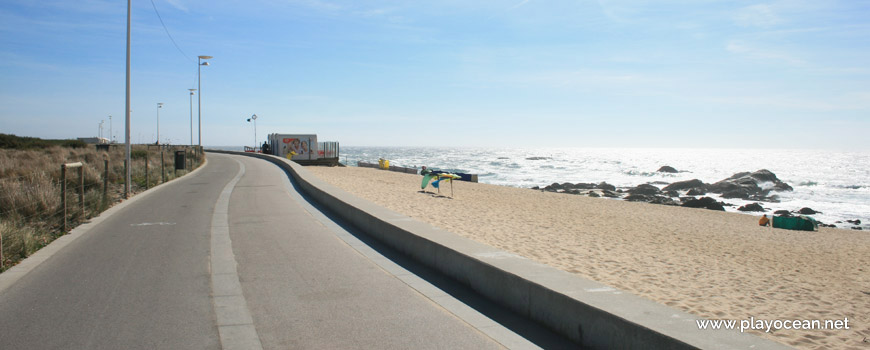
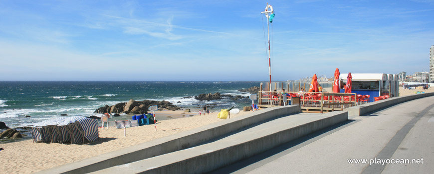
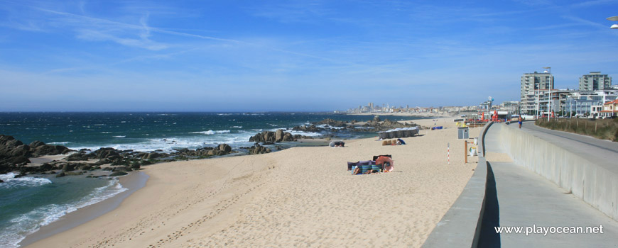
It's an Oceanic Beach in the northern hemisphere bathed by the Atlantic Ocean, located on the coast of Portugal - Iberian Peninsula - in the municipality of Vila do Conde.
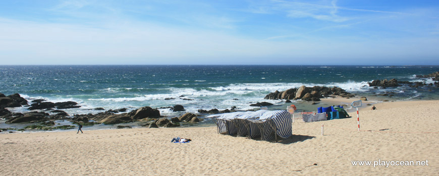
Praia Azul Beach presents a medium sized sand, belonging to the urbanistic area of Vila do Conde.
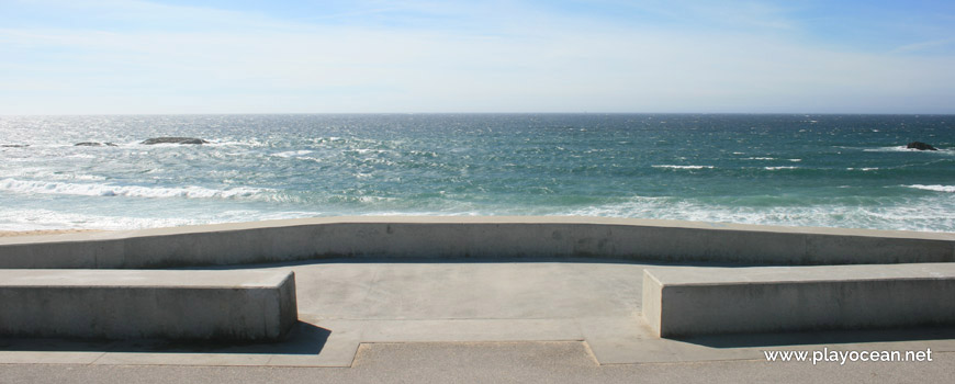
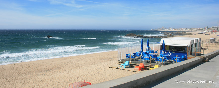
This beach is characterized by its stirred sea waters, therefore is very sought by water sports fans. Most of them are surfers who usually catch the waves immediately south of the islet that is visible about 150 meters off shore.
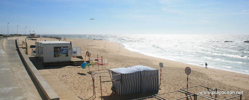
It's important to mention that during some summer seasons, according to the allocation of lifeguards, may exist an area of about 100 meters between this beach and the neighboring south decreed as "unsupervised beach."
Access is done through Avenida Manuel Barros1, also known as Marginal Atlântica2.
References
- Manuel de Barros Avenue
- Atlântica Costal Road
Where is it?
Map of Praia Azul Beach
| Coordinates Decimal Degrees (Lat/Long WGS84) Degrees, Decimal Minutes (Lat/Long WGS84) Degrees, Minutes, Seconds (Lat/Long WGS84) |
Lat. 41.347341º Lon. -8.753575º N 41º 20.84046' W 8º 45.2145' N 41º 20' 50.43" W 8º 45' 12.87" |
| Parish | Vila do Conde |
| County | Vila do Conde |
| District | Porto |
| Region | Douro Litoral |
| Country | Portugal |
| Continent | Europe |
| Ocean | North Atlantic |
| Maritime Authority | Capitania do Porto de Vila do Conde |
| Protected Area | Paisagem Protegida Regional do Litoral de Vila do Conde e Reserva Ornitológica de Mindelo |
| Bathing Water | Frente Urbana Sul |
| Coastal Unit | Cabo de Santo André - Foz do Douro (N) |
| Coastal Region | Costa Verde |
Awards
| Award | 2017 | 2016 | 2015 | 2014 | 2013 | 2012 | 2011 | 2010 | 2009 | 2008 | 2007 | 2006 |
|---|---|---|---|---|---|---|---|---|---|---|---|---|
| Water Quality | ||||||||||||
| Blue Flag | ||||||||||||
| Gold Flag | ||||||||||||
| Handicapped-Accessible Beach | ||||||||||||
| Zero Polution |
