Weather and Tide Table
Waning Gibbous Moon
Blustery
06h16
Sunrise
Sunrise
20h54
Sunset
Sunset
Seg
13 - 18
Ter
15 - 17
Qua
14 - 17
Qui
15 - 17
Sex
15 - 16
17
ºC
Air Temperature
NNW
31
km/h
Wind Speed and Direction
71
%
Relative Humidity
1017
mbar
Atmospheric Pressure
86%
Flood Tide
00h52
to High Tide
to High Tide
10:50
Low Tide
Low Tide
17:06
High Tide
High Tide
No Data
Water Temperature
No Data
Wave Direction
No Data
Wave Medium Height
No Data
Wave Medium Period
91% | 3,1 m 10.2 ft | High Tide | |
90% | 0,9 m 3 ft | Low Tide | |
88% | 3,1 m 10.2 ft | High Tide | |
87% | 0,9 m 3 ft | Low Tide | |
85% | 2,9 m 9.5 ft | High Tide | |
83% | 1,1 m 3.6 ft | Low Tide | |
81% | 3,0 m 9.8 ft | High Tide | |
79% | 1,1 m 3.6 ft | Low Tide | |
77% | 2,8 m 9.2 ft | High Tide | |
75% | 1,2 m 3.9 ft | Low Tide | |
73% | 2,8 m 9.2 ft | High Tide | |
71% | 1,3 m 4.3 ft | Low Tide | |
68% | 2,6 m 8.5 ft | High Tide | |
66% | 1,4 m 4.6 ft | Low Tide | |
63% | 2,7 m 8.9 ft | High Tide | |
61% | 1,4 m 4.6 ft | Low Tide | |
58% | 2,4 m 7.9 ft | High Tide | |
56% | 1,5 m 4.9 ft | Low Tide | |
53% | 2,6 m 8.5 ft | High Tide | |
50% | 1,5 m 4.9 ft | Low Tide | |
47% | 2,4 m 7.9 ft | High Tide | |
44% | 1,6 m 5.2 ft | Low Tide | |
42% | 2,6 m 8.5 ft | High Tide | |
39% | 1,4 m 4.6 ft | Low Tide | |
36% | 2,5 m 8.2 ft | High Tide | |
33% | 1,5 m 4.9 ft | Low Tide | |
31% | 2,8 m 9.2 ft | High Tide | |
28% | 1,2 m 3.9 ft | Low Tide | |
25% | 2,8 m 9.2 ft | High Tide | |
23% | 1,2 m 3.9 ft | Low Tide | |
20% | 3,0 m 9.8 ft | High Tide | |
18% | 0,9 m 3 ft | Low Tide | |
16% | 3,0 m 9.8 ft | High Tide | |
14% | 1,0 m 3.3 ft | Low Tide | |
11% | 3,3 m 10.8 ft | High Tide | |
10% | 0,7 m 2.3 ft | Low Tide | |
8% | 3,3 m 10.8 ft | High Tide | |
6% | 0,7 m 2.3 ft | Low Tide | |
5% | 3,5 m 11.5 ft | High Tide | |
4% | 0,5 m 1.6 ft | Low Tide | |
2% | 3,5 m 11.5 ft | High Tide | |
2% | 0,5 m 1.6 ft | Low Tide | |
About the Beach
What is Praia da Ingrina Beach?
Lifeguarded Beach from to
days for the start of bathing season
It's an Oceanic Beach in the northern hemisphere bathed by the Atlantic Ocean, located on the coast of Portugal - Iberian Peninsula - in the municipality of Vila do Bispo.
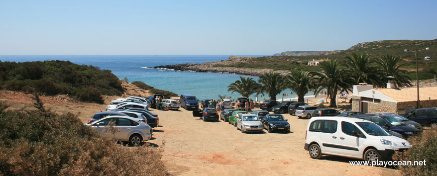
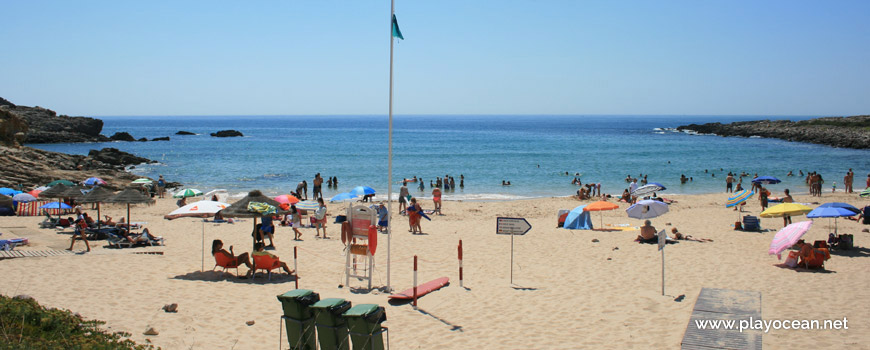
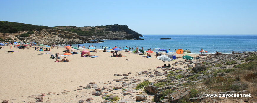
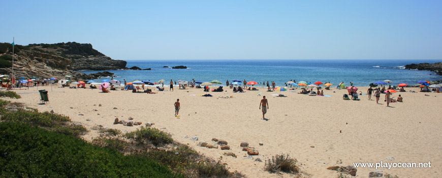
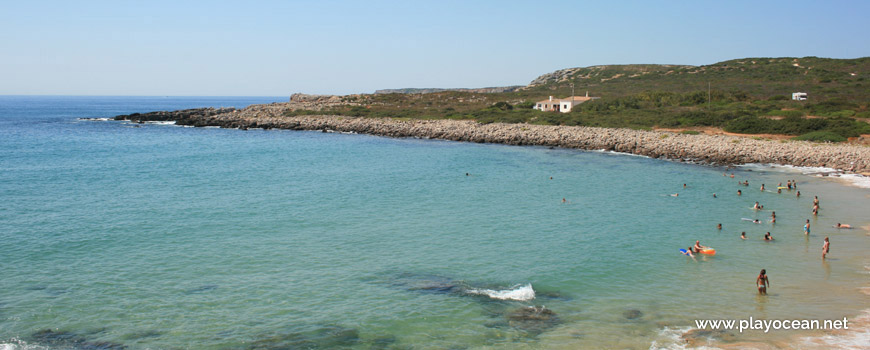
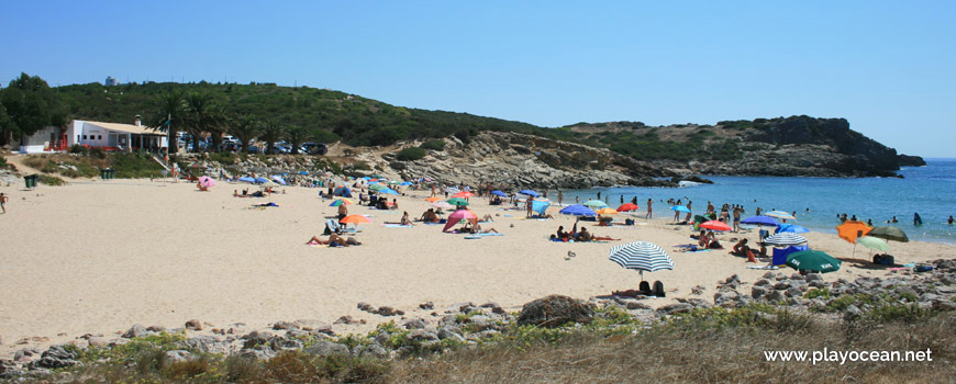
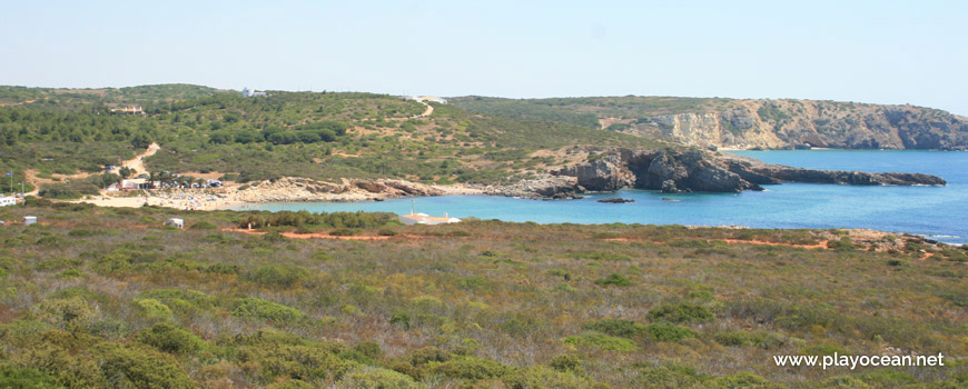
Praia da Ingrina Beach has a wide and reasonably extensive sand with the shape of a seashell. It's located in a small bay whose ends stretch more than 200 meters into the sea.
It's an enjoyable place for scuba diving.
The surroundings are famous for their megalithic monuments.
At east, the Ruínas do Forte e da Bateria do Zavial1 may be sighted on top of the cliff.
References
- Zavial Battery and Fort Ruins
Where is it?
Map of Praia da Ingrina Beach
| Coordinates Decimal Degrees (Lat/Long WGS84) Degrees, Decimal Minutes (Lat/Long WGS84) Degrees, Minutes, Seconds (Lat/Long WGS84) |
Lat. 37.046487º Lon. -8.879151º N 37º 2.78922' W 8º 52.74906' N 37º 2' 47.35" W 8º 52' 44.94" |
| Parish | Raposeira |
| County | Vila do Bispo |
| District | Faro |
| Region | Algarve |
| Country | Portugal |
| Continent | Europe |
| Ocean | North Atlantic |
| Maritime Authority | Capitania do Porto de Lagos |
| Protected Area | Parque Natural do Sudoeste Alentejano e Costa Vicentina |
| Bathing Water | Ingrina |
| Coastal Unit | Ponta de Sagres - Ponta Piedade |
| Coastal Region | Costa Vicentina |
Awards
| Award | 2017 | 2016 | 2015 | 2014 | 2013 | 2012 | 2011 | 2010 | 2009 | 2008 | 2007 | 2006 |
|---|---|---|---|---|---|---|---|---|---|---|---|---|
| Water Quality | ||||||||||||
| Blue Flag | ||||||||||||
| Gold Flag | ||||||||||||
| Handicapped-Accessible Beach | ||||||||||||
| Zero Polution |
Documents
Reviews
Login to Review.
or start session at
.
