Weather and Tide Table
Waxing Crescent Moon
Fair
21h03
Sunset
Sunset
06h08
Sunrise
Sunrise
Seg
12 - 20
Ter
12 - 20
Qua
13 - 20
Qui
13 - 20
Sex
13 - 21
15
ºC
Air Temperature
N
23
km/h
Wind Speed and Direction
74
%
Relative Humidity
1016
mbar
Atmospheric Pressure
12%
Flood Tide
05h33
to High Tide
to High Tide
23:20
Low Tide
Low Tide
05:40
High Tide
High Tide
No Data
Water Temperature
No Data
Wave Direction
No Data
Wave Medium Height
No Data
Wave Medium Period
11% | 3,7 m 12.1 ft | High Tide | |
13% | 0,4 m 1.3 ft | Low Tide | |
15% | 3,6 m 11.8 ft | High Tide | |
17% | 0,5 m 1.6 ft | Low Tide | |
20% | 3,4 m 11.2 ft | High Tide | |
22% | 0,7 m 2.3 ft | Low Tide | |
25% | 3,3 m 10.8 ft | High Tide | |
27% | 0,7 m 2.3 ft | Low Tide | |
30% | 3,1 m 10.2 ft | High Tide | |
33% | 1,0 m 3.3 ft | Low Tide | |
36% | 3,1 m 10.2 ft | High Tide | |
38% | 1,0 m 3.3 ft | Low Tide | |
41% | 2,8 m 9.2 ft | High Tide | |
44% | 1,3 m 4.3 ft | Low Tide | |
47% | 2,9 m 9.5 ft | High Tide | |
50% | 1,3 m 4.3 ft | Low Tide | |
53% | 2,6 m 8.5 ft | High Tide | |
55% | 1,5 m 4.9 ft | Low Tide | |
58% | 2,7 m 8.9 ft | High Tide | |
61% | 1,3 m 4.3 ft | Low Tide | |
64% | 2,5 m 8.2 ft | High Tide | |
66% | 1,5 m 4.9 ft | Low Tide | |
69% | 2,8 m 9.2 ft | High Tide | |
71% | 1,2 m 3.9 ft | Low Tide | |
74% | 2,6 m 8.5 ft | High Tide | |
76% | 1,4 m 4.6 ft | Low Tide | |
78% | 2,9 m 9.5 ft | High Tide | |
80% | 1,1 m 3.6 ft | Low Tide | |
82% | 2,8 m 9.2 ft | High Tide | |
84% | 1,2 m 3.9 ft | Low Tide | |
86% | 3,0 m 9.8 ft | High Tide | |
88% | 1,0 m 3.3 ft | Low Tide | |
89% | 2,9 m 9.5 ft | High Tide | |
91% | 1,0 m 3.3 ft | Low Tide | |
92% | 3,2 m 10.5 ft | High Tide | |
93% | 0,8 m 2.6 ft | Low Tide | |
95% | 3,1 m 10.2 ft | High Tide | |
96% | 0,9 m 3 ft | Low Tide | |
97% | 3,3 m 10.8 ft | High Tide | |
97% | 0,8 m 2.6 ft | Low Tide | |
98% | 3,2 m 10.5 ft | High Tide | |
99% | 0,8 m 2.6 ft | Low Tide | |
About the Beach
What is Praia do Salgado Beach?
Lifeguarded Beach from to
days for the start of bathing season
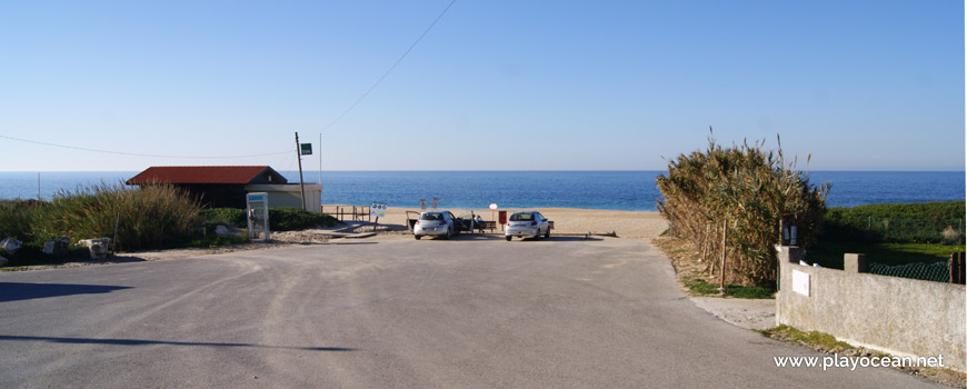
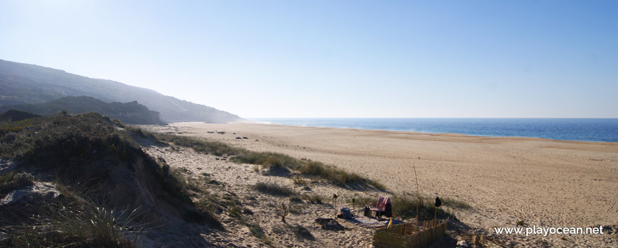
It's an Oceanic Beach in the northern hemisphere bathed by the Atlantic Ocean, located on the coast of Portugal - Iberian Peninsula - in the municipality of Nazaré.
Praia do Salgado Beach belongs to the Rio Alcobaça1 mouth - name of the Rio Alcoa2 final section after merging with the Rio Baça3, in Alcobaça - by the south margin.
A very lengthy sand of about 5,3 Km is paired with a vast dune system that gains more relevance in the central part and where can be found the Igreja de São Gião4.
People come here seeking for paragliding adventures.
The access is done via Estrada Nacional 2425, exiting towards west at Famalicão village and crossing the Serra da Pescaria6 until reaching the beach.
References
- Alcobaça River
- Alcoa River
- Baça River
- Saint Gião Church
- National Road 242
- Pescaria Sierra
Where is it?
Map of Praia do Salgado Beach
| Coordinates Decimal Degrees (Lat/Long WGS84) Degrees, Decimal Minutes (Lat/Long WGS84) Degrees, Minutes, Seconds (Lat/Long WGS84) |
Lat. 39.546975º Lon. -9.110543º N 39º 32.8185' W 9º 6.63258' N 39º 32' 49.11" W 9º 6' 37.95" |
| Parish | Famalicão |
| County | Nazaré |
| District | Leiria |
| Region | Estremadura |
| Country | Portugal |
| Continent | Europe |
| Ocean | North Atlantic |
| Maritime Authority | Capitania do Porto da Nazaré |
| Protected Area | |
| Bathing Water | Salgado |
| Coastal Unit | Pedra do Guilhim (Nazaré) - Ponta do Fach (São Martinho do Porto) |
| Coastal Region | Costa de Prata |
Awards
| Award | 2017 | 2016 | 2015 | 2014 | 2013 | 2012 | 2011 | 2010 | 2009 | 2008 | 2007 | 2006 |
|---|---|---|---|---|---|---|---|---|---|---|---|---|
| Water Quality | ||||||||||||
| Blue Flag | ||||||||||||
| Gold Flag | ||||||||||||
| Handicapped-Accessible Beach | ||||||||||||
| Zero Polution |
Documents
Reviews (1)
Login to Review.
or start session at
.
-
10/ 10Ideal beach for lovers of naturism and nudism, just use the right side of the beach without walking too much. Very extensive with golden sand. Sea is almost always very rough although. Sometime it is possible to find a green flag. Nudism is booming in this place.Paulo Ribeiro 2018-08-20 14:07

